
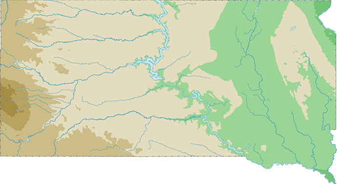
South Dakota Topographical Map
Static South Dakota Topo Map
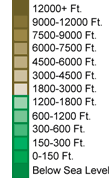
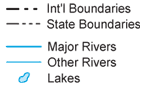
This section features a topographical map of South Dakota as well as a map legend that specifies elevation ranges and indicates their corresponding map colors.
Map Legend |
 |
|
 |
South Dakota Topographical Features
South Dakota's highest mountain is Harney Peak, whose peak is 7,242 feet above sea level. South Dakota's lowest elevation is 966 feet above sea level, at Big Stone Lake. South Dakota is a prairie state with the Prairie Hills in the east and Great Plains in the west, rising to the Black Hills in the far west. Major rivers in South Dakota include the Big Sioux, Vermillion, James, Grand, Moreau, and Cheyenne.Interactive South Dakota Topo Map
This section features a topographical map that can be zoomed and panned to show the entire State of South Dakota or a small portion of the state. To zoom in or out on the map, use the plus (+) button or the minus (-) button, respectively. To pan the map in any direction, simply swipe it or drag it in that direction. At high zoom levels, the contour lines on this South Dakota map can help outdoorsmen, land developers, and others to plan their routes and activities more efficiently.
Copyright © 2005-2024 State-Maps.org. All rights reserved.
South-Dakota-Map.org is a State Maps reference source.
South-Dakota-Map.org is a State Maps reference source.